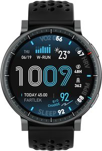
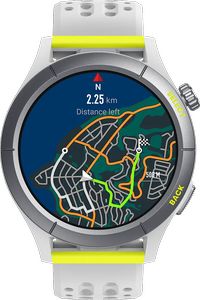
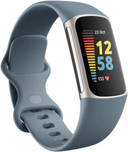
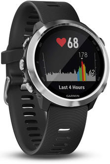
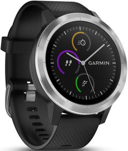
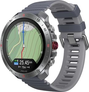
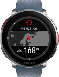
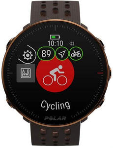
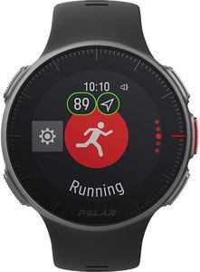
Crazy about accurately tracked pace, distance and route? There is no better way, as to use a fitness tracker or sports watch with build-in GPS. Wearables without GPS rely on the number of steps and the average distance of one step for a person of your age, body height and sex.
Though this approach seems fair, there are a lot of people that do not conform to the average value. Thus the results may vary considerably. Fortunately the size and costs of GPS chips have been reduced over the years, so that even wearables for beginners offer GPS functionality.
With build-in GPS you don’t have to take your smartphone with you in order to track the pace, distance and route. This list shows all the fitness trackers and sports watches that have build-in GPS.
142 matching products
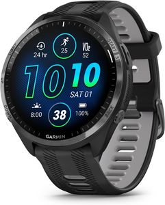
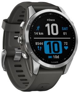
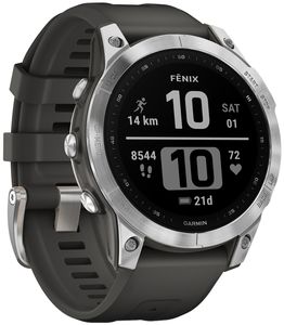
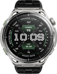
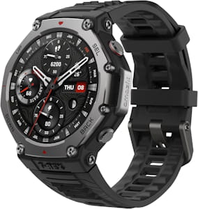
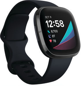
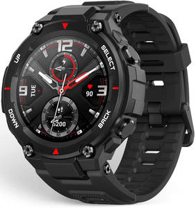
Q3/22 Sports watch
Activity Gesundheit Sport Smarte Funktionen Konnektivität Standort Musik 100 83 97 67 67 75 100 Q2/25 Sports watch
Activity Gesundheit Sport Smarte Funktionen Konnektivität Standort Musik 100 83 100 83 83 75 100 Q2/25 Sports watch
Activity Gesundheit Sport Smarte Funktionen Konnektivität Standort Musik 100 83 100 83 83 75 100 Q3/24 Sports watch
Activity Gesundheit Sport Smarte Funktionen Konnektivität Standort Musik 100 83 97 83 67 75 100 Q3/24 Sports watch
Activity Gesundheit Sport Smarte Funktionen Konnektivität Standort Musik 100 83 97 83 67 75 100 Q3/24 Sports watch
Activity Gesundheit Sport Smarte Funktionen Konnektivität Standort Musik 100 83 97 83 67 75 100 Q1/23 Sports watch
Activity Gesundheit Sport Smarte Funktionen Konnektivität Standort Musik 100 83 100 67 83 75 100 Q1/22 Sports watch
Activity Gesundheit Sport Smarte Funktionen Konnektivität Standort Musik 100 83 97 67 67 75 100 Q1/22 Sports watch
Activity Gesundheit Sport Smarte Funktionen Konnektivität Standort Musik 100 83 97 67 67 75 100 Q3/25 Smartwatch
Activity Gesundheit Sport Smarte Funktionen Konnektivität Standort Musik 100 100 99 83 67 75 100 Q3/25 Smartwatch
Activity Gesundheit Sport Smarte Funktionen Konnektivität Standort Musik 100 100 99 83 67 75 100 Q1/22 Sports watch
Activity Gesundheit Sport Smarte Funktionen Konnektivität Standort Musik 100 83 97 67 67 75 100 Q3/23 Smartwatch
Activity Gesundheit Sport Smarte Funktionen Konnektivität Standort Musik 100 83 81 83 67 75 100 Q1/22 Smartwatch
Activity Gesundheit Sport Smarte Funktionen Konnektivität Standort Musik 100 100 81 67 67 75 100 Q2/21 Smartwatch
Activity Gesundheit Sport Smarte Funktionen Konnektivität Standort Musik 100 83 81 67 67 75 100 Q1/22 Sports watch
Activity Gesundheit Sport Smarte Funktionen Konnektivität Standort Musik 100 83 97 67 67 75 100 Q1/22 Sports watch
Activity Gesundheit Sport Smarte Funktionen Konnektivität Standort Musik 100 83 97 67 67 75 100 Q1/22 Sports watch
Activity Gesundheit Sport Smarte Funktionen Konnektivität Standort Musik 100 83 97 67 67 75 100 Q1/22 Sports watch
Activity Gesundheit Sport Smarte Funktionen Konnektivität Standort Musik 100 83 97 67 67 75 100 Q1/22 Sports watch
Activity Gesundheit Sport Smarte Funktionen Konnektivität Standort Musik 100 83 97 67 67 75 100 Q1/22 Sports watch
Activity Gesundheit Sport Smarte Funktionen Konnektivität Standort Musik 100 83 97 67 67 75 100 Q2/21 Smartwatch
Activity Gesundheit Sport Smarte Funktionen Konnektivität Standort Musik 100 83 81 67 67 75 100 Q2/22 Sports watch
Activity Gesundheit Sport Smarte Funktionen Konnektivität Standort Musik 100 67 100 67 83 75 100 Q2/22 Sports watch
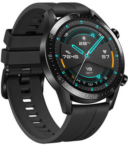
Activity Gesundheit Sport Smarte Funktionen Konnektivität Standort Musik 100 67 100 67 83 75 100 Q3/22 Smartwatch
Activity Gesundheit Sport Smarte Funktionen Konnektivität Standort Musik 80 83 81 67 67 75 100 Q2/21 Sports watch
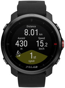
Activity Gesundheit Sport Smarte Funktionen Konnektivität Standort Musik 100 83 97 67 83 75 100 Q3/19 Sports watch
Activity Gesundheit Sport Smarte Funktionen Konnektivität Standort Musik 100 83 97 67 67 75 100 Q2/19 Sports watch
Activity Gesundheit Sport Smarte Funktionen Konnektivität Standort Musik 100 67 97 67 67 75 100 Q2/26 Smartwatch
Activity Gesundheit Sport Smarte Funktionen Konnektivität Standort Musik 100 83 74 83 67 75 40 Q2/26 Smartwatch
Activity Gesundheit Sport Smarte Funktionen Konnektivität Standort Musik 100 83 74 83 67 75 40 Q4/24 Sports watch
Activity Gesundheit Sport Smarte Funktionen Konnektivität Standort Musik 100 83 91 33 33 75 20 Q1/23 Sports watch
Activity Gesundheit Sport Smarte Funktionen Konnektivität Standort Musik 100 83 90 67 67 75 100 Q2/18 Sports watch
Activity Gesundheit Sport Smarte Funktionen Konnektivität Standort Musik 100 83 97 67 67 75 100 Q1/23 Sports watch
Activity Gesundheit Sport Smarte Funktionen Konnektivität Standort Musik 100 83 90 67 67 75 100 Q4/25 Sports watch
Activity Gesundheit Sport Smarte Funktionen Konnektivität Standort Musik 100 83 89 83 50 75 20 Q3/23 Smartwatch
Activity Gesundheit Sport Smarte Funktionen Konnektivität Standort Musik 100 83 77 67 50 75 40 Q3/19 Sports watch
Activity Gesundheit Sport Smarte Funktionen Konnektivität Standort Musik 100 83 81 67 67 75 100 Q2/25 Sports watch
Activity Gesundheit Sport Smarte Funktionen Konnektivität Standort Musik 100 83 86 67 67 75 100 Q3/22 Smartwatch
Activity Gesundheit Sport Smarte Funktionen Konnektivität Standort Musik 80 83 81 67 67 75 20 Q1/25 Sports watch
Activity Gesundheit Sport Smarte Funktionen Konnektivität Standort Musik 100 83 90 67 50 75 20 Q3/20 Sports watch
Activity Gesundheit Sport Smarte Funktionen Konnektivität Standort Musik 100 83 99 67 67 75 100 Q3/23 Sports watch
Activity Gesundheit Sport Smarte Funktionen Konnektivität Standort Musik 100 83 81 67 67 75 100 Q3/19 Sports watch
Activity Gesundheit Sport Smarte Funktionen Konnektivität Standort Musik 100 83 81 67 67 75 100 Q3/19 Sports watch
Activity Gesundheit Sport Smarte Funktionen Konnektivität Standort Musik 100 83 97 67 50 75 20 Q3/23 Sports watch
Activity Gesundheit Sport Smarte Funktionen Konnektivität Standort Musik 100 67 88 33 33 75 20 Q2/22 Sports watch
Activity Gesundheit Sport Smarte Funktionen Konnektivität Standort Musik 100 83 90 67 67 75 100 Q2/26 Sports watch
Activity Gesundheit Sport Smarte Funktionen Konnektivität Standort Musik 100 83 82 83 67 75 40 Q2/18 Sports watch
Activity Gesundheit Sport Smarte Funktionen Konnektivität Standort Musik 100 33 81 67 67 50 100 Q1/18 Sports watch
Activity Gesundheit Sport Smarte Funktionen Konnektivität Standort Musik 100 33 80 67 50 50 100 Q4/23 Smartwatch
Activity Gesundheit Sport Smarte Funktionen Konnektivität Standort Musik 100 83 73 83 67 75 40 Q4/22 Smartwatch
Activity Gesundheit Sport Smarte Funktionen Konnektivität Standort Musik 100 83 70 67 50 75 40 Q3/25 Smartwatch
Activity Gesundheit Sport Smarte Funktionen Konnektivität Standort Musik 80 83 84 75 67 75 40 Q3/24 Smartwatch
Activity Gesundheit Sport Smarte Funktionen Konnektivität Standort Musik 80 67 80 58 67 75 40 Q1/17 Sports watch
Activity Gesundheit Sport Smarte Funktionen Konnektivität Standort Musik 100 33 93 67 50 75 20 Q1/24 Sports watch
Activity Gesundheit Sport Smarte Funktionen Konnektivität Standort Musik 100 83 86 67 67 75 100 Q2/23 Sports watch
Activity Gesundheit Sport Smarte Funktionen Konnektivität Standort Musik 100 83 90 67 67 75 20 Q1/26 Sports watch
Activity Gesundheit Sport Smarte Funktionen Konnektivität Standort Musik 100 83 89 83 50 75 20 Q4/21 Smartwatch
Activity Gesundheit Sport Smarte Funktionen Konnektivität Standort Musik 100 83 73 67 50 75 40 Q4/21 Smartwatch
Activity Gesundheit Sport Smarte Funktionen Konnektivität Standort Musik 100 83 68 67 50 75 40 Q4/23 Sports watch
Activity Gesundheit Sport Smarte Funktionen Konnektivität Standort Musik 60 33 74 58 33 75 20 Q2/22 Sports watch
Activity Gesundheit Sport Smarte Funktionen Konnektivität Standort Musik 100 83 90 67 50 75 20 Q1/25 Sports watch
Activity Gesundheit Sport Smarte Funktionen Konnektivität Standort Musik 80 83 89 83 50 75 20 Q4/21 Smartwatch
Activity Gesundheit Sport Smarte Funktionen Konnektivität Standort Musik 100 83 76 58 17 50 40 Q3/23 Sports watch
Activity Gesundheit Sport Smarte Funktionen Konnektivität Standort Musik 100 83 77 67 50 75 40 Q3/23 Sports watch
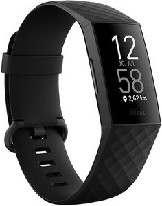
Activity Gesundheit Sport Smarte Funktionen Konnektivität Standort Musik 100 83 77 83 50 75 40 Q3/20 Fitness Tracker
Activity Gesundheit Sport Smarte Funktionen Konnektivität Standort Musik 80 83 81 67 67 75 100 Q4/23 Fitness Tracker
Activity Gesundheit Sport Smarte Funktionen Konnektivität Standort Musik 100 83 57 25 33 75 0 Q4/21 Fitness Tracker
Activity Gesundheit Sport Smarte Funktionen Konnektivität Standort Musik 100 83 57 25 33 75 0 Q1/24 Sports watch
Activity Gesundheit Sport Smarte Funktionen Konnektivität Standort Musik 100 83 86 67 67 75 20 Q1/18 Sports watch
Activity Gesundheit Sport Smarte Funktionen Konnektivität Standort Musik 100 33 82 67 50 50 20 Q4/23 Sports watch
Activity Gesundheit Sport Smarte Funktionen Konnektivität Standort Musik 60 33 74 33 17 75 20 Q3/17 Sports watch
Activity Gesundheit Sport Smarte Funktionen Konnektivität Standort Musik 100 33 81 67 50 50 20 Q4/24 Sports watch
Activity Gesundheit Sport Smarte Funktionen Konnektivität Standort Musik 80 67 94 33 17 75 20 Q1/24 Sports watch
Activity Gesundheit Sport Smarte Funktionen Konnektivität Standort Musik 80 67 94 33 17 75 20 Q4/23 Sports watch
Activity Gesundheit Sport Smarte Funktionen Konnektivität Standort Musik 80 67 94 33 17 75 20 Q3/19 Smartwatch
Activity Gesundheit Sport Smarte Funktionen Konnektivität Standort Musik 100 67 74 67 67 75 20 Q2/19 Sports watch
Activity Gesundheit Sport Smarte Funktionen Konnektivität Standort Musik 100 67 74 67 67 75 100 Q4/22 Sports watch
Activity Gesundheit Sport Smarte Funktionen Konnektivität Standort Musik 80 33 88 25 50 75 0 Q4/22 Sports watch
Activity Gesundheit Sport Smarte Funktionen Konnektivität Standort Musik 80 33 88 25 50 75 0 Q2/23 Sports watch
Activity Gesundheit Sport Smarte Funktionen Konnektivität Standort Musik 60 33 74 33 33 75 20 Q2/25 Smartwatch
Activity Gesundheit Sport Smarte Funktionen Konnektivität Standort Musik 80 83 63 67 33 75 20 Q4/21 Sports watch
Activity Gesundheit Sport Smarte Funktionen Konnektivität Standort Musik 80 17 94 33 17 75 20 Q4/21 Sports watch
Activity Gesundheit Sport Smarte Funktionen Konnektivität Standort Musik 80 17 94 33 17 75 20 Q3/19 Sports watch
Activity Gesundheit Sport Smarte Funktionen Konnektivität Standort Musik 100 33 71 58 33 75 40 Q3/20 Sports watch
Activity Gesundheit Sport Smarte Funktionen Konnektivität Standort Musik 60 0 88 25 33 75 0 Q2/19 Sports watch
Activity Gesundheit Sport Smarte Funktionen Konnektivität Standort Musik 60 33 74 25 17 75 0 Q2/19 Sports watch
Activity Gesundheit Sport Smarte Funktionen Konnektivität Standort Musik 100 67 74 67 50 75 20 Q2/22 Smartwatch
Activity Gesundheit Sport Smarte Funktionen Konnektivität Standort Musik 80 67 77 58 33 75 20 Q4/20 Sports watch
Activity Gesundheit Sport Smarte Funktionen Konnektivität Standort Musik 80 17 94 33 17 75 20 Q3/23 Smartwatch
Activity Gesundheit Sport Smarte Funktionen Konnektivität Standort Musik 100 83 72 50 50 75 40 Q3/23 Smartwatch
Activity Gesundheit Sport Smarte Funktionen Konnektivität Standort Musik 100 83 72 50 50 75 40 Q2/26 Sports watch
Activity Gesundheit Sport Smarte Funktionen Konnektivität Standort Musik 80 100 66 83 33 75 20 Q1/25 Sports watch
Activity Gesundheit Sport Smarte Funktionen Konnektivität Standort Musik 100 83 90 67 50 75 0 Q1/25 Sports watch
Activity Gesundheit Sport Smarte Funktionen Konnektivität Standort Musik 100 83 90 67 50 75 0 Q2/20 Smartwatch
Activity Gesundheit Sport Smarte Funktionen Konnektivität Standort Musik 100 100 56 58 50 75 20 Q2/20 Fitness Tracker
Activity Gesundheit Sport Smarte Funktionen Konnektivität Standort Musik 100 33 57 42 33 75 0 Q3/24 Smartwatch
Activity Gesundheit Sport Smarte Funktionen Konnektivität Standort Musik 60 67 66 50 50 75 40 Q3/23 Smartwatch
Activity Gesundheit Sport Smarte Funktionen Konnektivität Standort Musik 60 83 66 50 50 75 40 Q2/20 Sports watch
Activity Gesundheit Sport Smarte Funktionen Konnektivität Standort Musik 80 17 94 33 17 75 0 Smartwatch
Activity Gesundheit Sport Smarte Funktionen Konnektivität Standort Musik 100 83 72 33 17 50 40 Smartwatch
Activity Gesundheit Sport Smarte Funktionen Konnektivität Standort Musik 100 83 72 33 17 50 40 Q3/18 Sports watch
Activity Gesundheit Sport Smarte Funktionen Konnektivität Standort Musik 60 0 63 25 17 75 0 Q2/26 Sports watch
Activity Gesundheit Sport Smarte Funktionen Konnektivität Standort Musik 80 83 66 83 33 75 20 Q3/23 Smartwatch
Activity Gesundheit Sport Smarte Funktionen Konnektivität Standort Musik 80 83 63 83 33 75 20 Q2/21 Sports watch
Activity Gesundheit Sport Smarte Funktionen Konnektivität Standort Musik 80 0 96 33 17 75 20 Q3/19 Fitness Tracker
Activity Gesundheit Sport Smarte Funktionen Konnektivität Standort Musik 80 0 48 33 17 50 20 Q3/18 Sports watch
Activity Gesundheit Sport Smarte Funktionen Konnektivität Standort Musik 80 17 94 25 17 50 0 Q4/20 Fitness Tracker
Activity Gesundheit Sport Smarte Funktionen Konnektivität Standort Musik 80 67 54 33 50 50 40 Q4/22 Sports watch
Activity Gesundheit Sport Smarte Funktionen Konnektivität Standort Musik 80 17 77 33 33 75 20 Q4/23 Smartwatch
Activity Gesundheit Sport Smarte Funktionen Konnektivität Standort Musik 100 100 61 58 67 75 60 Q4/23 Smartwatch
Activity Gesundheit Sport Smarte Funktionen Konnektivität Standort Musik 100 100 61 75 83 75 60 Q4/22 Smartwatch
Activity Gesundheit Sport Smarte Funktionen Konnektivität Standort Musik 100 100 61 58 67 75 60 Q2/21 Sports watch
Activity Gesundheit Sport Smarte Funktionen Konnektivität Standort Musik 100 83 53 67 33 75 20 Q3/16 Smartwatch
Activity Gesundheit Sport Smarte Funktionen Konnektivität Standort Musik 80 0 83 67 33 50 40 Q3/17 Fitness Tracker
Activity Gesundheit Sport Smarte Funktionen Konnektivität Standort Musik 100 33 46 33 33 25 20 Q4/20 Smartwatch
Activity Gesundheit Sport Smarte Funktionen Konnektivität Standort Musik 100 0 47 67 67 50 40 Q1/20 Smartwatch
Activity Gesundheit Sport Smarte Funktionen Konnektivität Standort Musik 100 0 47 67 50 50 40 Q2/20 Fitness Tracker
Activity Gesundheit Sport Smarte Funktionen Konnektivität Standort Musik 80 0 51 33 17 50 20 Q3/20 Sports watch
Activity Gesundheit Sport Smarte Funktionen Konnektivität Standort Musik 100 67 57 42 33 75 20 Q3/22 Smartwatch
Activity Gesundheit Sport Smarte Funktionen Konnektivität Standort Musik 100 100 56 33 33 50 0 Q3/22 Smartwatch
Activity Gesundheit Sport Smarte Funktionen Konnektivität Standort Musik 100 100 56 33 50 50 0 Q2/22 Sports watch
Activity Gesundheit Sport Smarte Funktionen Konnektivität Standort Musik 80 17 92 33 33 75 20 Q2/21 Sports watch
Activity Gesundheit Sport Smarte Funktionen Konnektivität Standort Musik 80 17 77 33 17 75 20 Q3/18 Sports watch
Activity Gesundheit Sport Smarte Funktionen Konnektivität Standort Musik 60 0 93 0 17 50 0 Q2/16 Sports watch
Activity Gesundheit Sport Smarte Funktionen Konnektivität Standort Musik 100 0 67 42 33 50 20 Q2/19 Sports watch
Activity Gesundheit Sport Smarte Funktionen Konnektivität Standort Musik 100 67 50 42 33 75 20 Q2/19 Sports watch
Activity Gesundheit Sport Smarte Funktionen Konnektivität Standort Musik 80 17 89 25 17 50 0 Q1/19 Smartwatch
Activity Gesundheit Sport Smarte Funktionen Konnektivität Standort Musik 80 0 32 58 33 50 40 Q3/17 Smartwatch
Activity Gesundheit Sport Smarte Funktionen Konnektivität Standort Musik 80 17 66 58 50 50 40 Q4/20 Smartwatch
Activity Gesundheit Sport Smarte Funktionen Konnektivität Standort Musik 80 67 54 33 50 75 40 Q1/19 Sports watch
Activity Gesundheit Sport Smarte Funktionen Konnektivität Standort Musik 80 50 47 67 50 50 40 Fitness Tracker
Activity Gesundheit Sport Smarte Funktionen Konnektivität Standort Musik 80 0 56 33 17 25 0 Q1/21 Smartwatch
Activity Gesundheit Sport Smarte Funktionen Konnektivität Standort Musik 80 33 54 33 33 75 20 Q2/24 Sports watch
Activity Gesundheit Sport Smarte Funktionen Konnektivität Standort Musik 80 83 51 50 33 75 20 Q2/22 Sports watch
Activity Gesundheit Sport Smarte Funktionen Konnektivität Standort Musik 80 83 51 50 33 75 20 Q2/20 Smartwatch
Activity Gesundheit Sport Smarte Funktionen Konnektivität Standort Musik 100 50 56 58 50 50 20 Q1/20 Smartwatch
Activity Gesundheit Sport Smarte Funktionen Konnektivität Standort Musik 80 0 48 33 17 50 20 Q3/23 Sports watch
Activity Gesundheit Sport Smarte Funktionen Konnektivität Standort Musik 80 83 49 33 17 75 20 Q2/14 Sports watch
Activity Gesundheit Sport Smarte Funktionen Konnektivität Standort Musik 80 0 92 25 17 50 0 Q2/15 Sports watch
Activity Gesundheit Sport Smarte Funktionen Konnektivität Standort Musik 80 0 34 0 33 50 0 Q3/14 Fitness Tracker Sports watch
Activity Gesundheit Sport Smarte Funktionen Konnektivität Standort Musik 80 0 50 25 17 25 0 Q2/16 Fitness Tracker
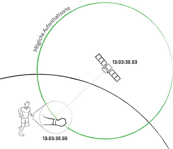
Activity Gesundheit Sport Smarte Funktionen Konnektivität Standort Musik 60 0 37 25 33 50 20 How does GPS work? To understand how distance and pace are measured, it is important to understand how a GPS device can locate your position by receiving the GPS signal.
Finding your position The Global Positioning System – or short GPS – is a system of 30 satellites that orbit the earth at about 20,000 kilometer height. The reason for using so many satellites can be described best, when describing the purpose of just one satellite first.
Each satellite consists of an atomic clock and is broadcasting its position along with the atomic clock’s time to earth continuously. When received by a GPS device, the device can calculate the distance between itself and the satellite based on how long it took the signal to arrive on earth.
Positioning using GPS
For convenience, let’s consider the earth that you are standing on is flat. The mechanisms for locating a position on a sphere are the same, but not necessary for getting the basic idea.
Let’s get back to the distance between you and a satellite. Once you have the distance you can be sure to be somewhere on a circle that is the intersection of our “flat” earth and the sphere with its radius being the distance between you and the satellite.
This applies for the distance derived from a second satellite as well. Most likely the distance between you and the satellite will differ from the first, i.e. you can be pretty sure to be somewhere on a second circle and that circle being the intersection of the “distance sphere” and the “flat” earth.
As your position is somewhere located on the first circle and at the same time is somewhere located on the second circle they must have something in common – they intersect.
When two circles intersect, they do so in two points. Given this information you can be sure that your location is either the first or the second intersection.
A third satellite is needed to give you the missing piece of information. The whole process is called trilateration and as you can see it requires at least three satellites. With more satellites used resulting in a more precise result.
Now it becomes obvious why so many satellites are needed: If one satellite sets behind the horizon, another satellite must appear above the horizon. To ensure that at least four satellites are “visible”, they a distribute in a smart manner around the earth.
Tracking of pace, distance and route To track the pace, distance and route, the GPS device has to locate your position continuously and calculate the distance between two adjacent positions. A short interval between two trilaterations allows for greater accurancy.